| Date |
April 29, 2024
|
|---|---|
| Content Type |
Announcement
|

|
The longest running CoastWatch product, regional sea surface temperature (SST) from the AVHRR instrument, will no longer be distributed through NOAA CoastWatch as of July 01, 2024. These products have been superseded by the enterprise ACSPO SST products. Please configure any dependency on the legacy CoastWatch SST product to use the ACSPO SST products such as the Level 3 supercollated SST described on the CoastWatch website. CoastWatch offers tools to subset global files to your region of interest. Check the forum, or ask the CoastWatch Help Desk for assistance.
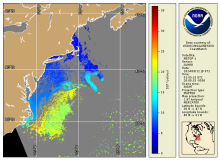
The 'legacy' regional products were derived from the Advanced Very High Resolution Radiometer instrument aboard NOAA polar orbiters beginning with NOAA-12. Local Area Coverage (LAC) and High Resolution Picture Transmission (HRPT) data were used to produce CoastWatch products which included an 8-bit graphics plane in addition to the channel radiance and sea surface temperature. Multiple algorithms and methodologies were used to generate the SSTs (Multi-Channel, non-linear, split-window, triple window, day-time, night-time) creating a plethora of products to accommodate application requirements. The graphics plane provided bit masking for land, cloud (various tests), and water. Products were considered regional (1.1-1.8km) or synoptic (4 - 6km) and typically dimensions with 512 or 1024 pixels. Thus, coastal "full resolution" coverage for a given CoastWatch Region required multiple sub-regions to achieve complete coverage. A separate product file was written to capture each band and product resulting in a cryptic list of filenames and extensions for each node. The lower resolution "Synoptic View" was also available generated from the original swath data. These operational products (initially in 'cwf' and later 'hdf' formats) were archived using the NOAA Comprehensive Large Array-data Stewardship System (CLASS).
