The ACSPO MODIS SST data are produced from Terra and Aqua satellites using the NOAA Advanced Clear-Sky Processor for Ocean (ACSPO) enterprise system (Ignatov et al., 2016). Complete archive of ACSPO MODIS SST data is available for both the Terra (24 Feb 2000 - present) and Aqua (4 July 2002 - present) missions in 0.02° L3C (level 3 collated) format. New data is added in delayed mode (DM) with a 2-month latency. The last orbital maintenance maneuvers for Aqua and Terra were performed on 27 Feb 2020 (Terra) and 18 Mar 2021 (Aqua) and their orbit has been drifting ever since. We do not recommend usage of ACSPO MODIS SST dated a year or later after each satellites' last orbital maintenance maneuver. For more recent SST data from low earth orbit satellites, we recommend the ACSPO VIIRS and AVHRR FRAC datasets.
Data Access
| Sample Filenames | Terra L3C (night): 20120721120000-STAR-L3C_GHRSST-SSTsubskin-MODIS_T_N-ACSPO_V2.80-v02.0-fv01.0.nc Aqua L3C (night): 20120721120000-STAR-L3C_GHRSST-SSTsubskin-MODIS_A_N-ACSPO_V2.80-v02.0-fv01.0nc
|
| HTTPS | Reanalysis / Reprocessed (RAN) [New data is added in delayed mode (DM) with a 2 month delay] L3C: https://coastwatch.noaa.gov/pub/socd2/coastwatch/sst/ran/modis/ |
| THREDDS | Reanalysis / Reprocessed (RAN) [New data is added in delayed mode (DM) with a 2 month delay] L3C: https://coastwatch.noaa.gov/thredds/socd/coastwatch/acspo/catalog_sst_acspo_modis_ran.html |
Product Overview
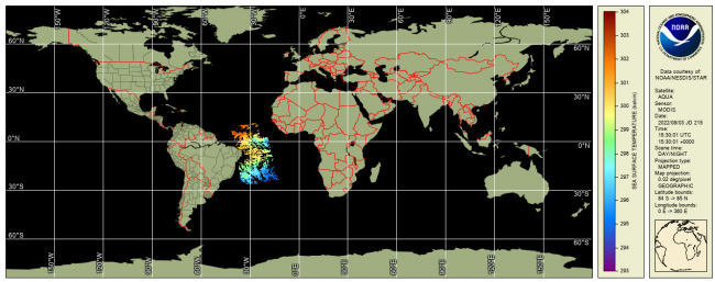
The MODIS SST data are produced from Terra and Aqua satellites using the NOAA Advanced Clear-Sky Processor for Ocean (ACSPO) enterprise system (Ignatov et al., 2016). Complete archive of ACSPO MODIS SST data is available for the entire Terra (24 Feb 2000-present) and Aqua (4 July 2002-present) missions in L3C (level 3 collated; 0.02°) format. New data is added in delayed mode (DM) with a 2-month latency. The last orbital maintenance maneuvers for Aqua and Terra were performed on 27 Feb 2020 (Terra) and 18 Mar 2021 (Aqua) and their orbit has been drifting ever since. We do not recommend usage of ACSPO MODIS SST dated a year or later after each satellites' last orbital maintenance maneuver. For more recent SST data fromlow earth orbit satellites, we recommend the ACSPO VIIRS and AVHRR FRAC datasets.
The data are reported daily, separated into daytime and nighttime viewing conditions (two files per 24hr) in GHRSST Data Specifications v2 (GDS2) format, in 0.02° gridded L3C (C=collated), 2 files per day, with a total data volume of 0.4 GB/day.
ACSPO retrievals are made in full MODIS swath (~2,300 km). For data assimilation applications (such as production of L4 analyses, especially those that blend satellite and in situ data), correction for the Sensor-Specific Error Statistics (SSES; reported in ACSPO files; Petrenko et al., 2016) biases is strongly recommended.
The following layers are reported in L3C files: SSTs derived using the Non-Linear SST (NLSST) algorithm (Petrenko et al., 2014); ACSPO clear-sky mask (ACSM; provided in each pixel as part of l2p_flags; Petrenko et al., 2010); SSES bias and standard deviation (Petrenko et al., 2016); MERRA2 wind speed; and ACSPO SST minus reference (Canadian Met Centre L4 SST). Only ACSM "confidently clear" pixels (equivalent to GDS2 "quality level"=5; also reported for each pixel) should be used. The ACSM also provides day/night, land, ice, twilight, and glint flags.
MODIS SST is monitored and validated against in situ data (Xu and Ignatov, 2014) in SQUAM (Dash et al., 2010) and ARMS (Ding et al., 2017) systems, and BTs are monitored in MICROS (Liang and Ignatov, 2011).
Product Details
24 Feb 2000-present (Terra)
4 July 2002-present (Aqua)
2 months
L3C: 0.02°
Documentation
- Dash, P., A. Ignatov, Y. Kihai & J. Sapper, 2010: The SST Quality Monitor (SQUAM). JTech, 27, 1899-1917, doi:10.1175/2010JTECHO756.1, www.star.nesdis.noaa.gov/sod/sst/squam/
- Ding, Y., A. Ignatov, I. Gladkova, M. Crosberg, and C. Chu, 2017: ACSPO Regional Monitor for SST (ARMS). BoM - NOAA SST Workshop, 18-21 April 2017, Melbourne, Australia (presentation), www.star.nesdis.noaa.gov/sod/sst/arms/
- Liang, X. & A. Ignatov, 2011: Monitoring of IR Clear-sky Radiances over Oceans for SST (MICROS). JTech, 28, 1228-1242, doi:10.1175/JTECH-D-10-05023.1, www.star.nesdis.noaa.gov/sod/sst/micros/
- Xu, F. & A. Ignatov, 2014: In situ SST Quality Monitor (iQuam). JTech, 31, 164-180, doi:10.1175/JTECH-D-13-00121.1, www.star.nesdis.noaa.gov/sod/sst/iquam/
- Petrenko, B., A. Ignatov, Y. Kihai, P. Dash, 2016: Sensor-Specific Error Statistics for SST in the Advanced Clear-Sky Processor for Oceans. JTech, 33, 345-359, doi:10.1175/JTECH-D-15-0166.1
- Petrenko, B., A. Ignatov, Y. Kihai, J. Stroup, P. Dash, 2014: Evaluation and Selection of SST Regression Algorithms for JPSS VIIRS. JGR, 119, 4580-4599, doi:10.1002/2013JD020637
- Petrenko, B., A. Ignatov, Y. Kihai, and A. Heidinger, 2010: Clear-Sky Mask for ACSPO. JTech, 27, 1609-1623, doi:10.1175/2010JTECHA1413.1
Citation
The ACSPO MODIS SST data are provided by NOAA STAR. We strongly recommend contacting NOAA SST team led by A. Ignatov before the data are used for any publication or presentation.