The Marine Optical BuoY (MOBY) project provides in situ data for the vicarious calibration of ocean color satellite data (Clark et al., 1997). MOBY is a hyperspectral optical instrument system moored off the island of Lanai in Hawaii. The system was designed for measuring sunlight incident on (surface irradiance) and emitted out of (water-leaving radiance) the ocean. These measurements are provided in near real time for the vicarious calibration procedures conducted by ocean color scientists and also used for routine monitoring of satellite sensor performance. MOBY has been funded by NOAA since October 2007.
Data Access
Product Overview
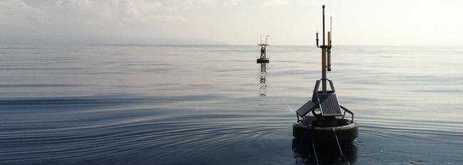
The Marine Optical BuoY (MOBY) project provides in situ data for the vicarious calibration of ocean color satellite data (Clark et al., 1997). MOBY is an hyperspectral optical instrument system which is moored off the island of Lanai in Hawaii. The system was designed for measuring sunlight incident on (surface irradiance) and emitted out of (water-leaving radiance) the ocean. These measurements are provided in near real time for the vicarious calibration procedures conducted by ocean color scientists and also used for routine monitoring of satellite sensor performance. Vicarious calibration of the system, which accounts for satellite sensor and atmospheric correction factors, requires a relatively homogenous and consistent optical ocean environment in a relatively accessible location to facilitate routine operations and maintenance. The development of MOBY began in 1985, followed by deployments of prototypes; first in Monterey Bay (1993) and then in Hawaii (1995). The operational version was tested in the fall of 1996 in Hawaii, and MOBY became operational at the Lanai site in July of 1997. MOBY collects data on a daily basis. Moss Landing Marine Laboratories (MLML) was selected through a NOAA grant process to participate in the engineering and construction of the prototype and operational version of the system in 1989. Additionally, MLML has had the primary responsibility for maintaining, calibrating the buoy and data production of the system. The MOBY project has been funded by NOAA since October 2007.
Product Details
| Short Names |
MOBY GOLD
MOBY SPECTRAL
MOBY PLATINUM
|
|---|---|
| Temporal Start Date |
July 20, 1997
|
| Product Families |
Field Observations (In situ)
Ocean Color
|
| Measurements |
Ocean Color Calibration
|
| Processing Levels |
Level 1
|
| Latency Groups |
24+ hours (Delayed)
|
| Latency Details |
3+ days |
| Data Providers |
NOAA
SJSU
|
Spatial Coverage
Field Observations
| Description |
Geographically scattered data points |
|---|