The NOAA geo-polar blended SST is a daily 0.05° (~5km) global high resolution satellite-based sea surface temperature (SST) Level-4 analyses generated on an operational basis. This analysis combines SST data from US, Japanese and European geostationary infrared imagers, and low-earth orbiting infrared (U.S. and European) SST data, into a single high-resolution 5-km product. The three flavors of blended SST products are night only; day/night, and diurnal warming.
Data Access
Product Overview
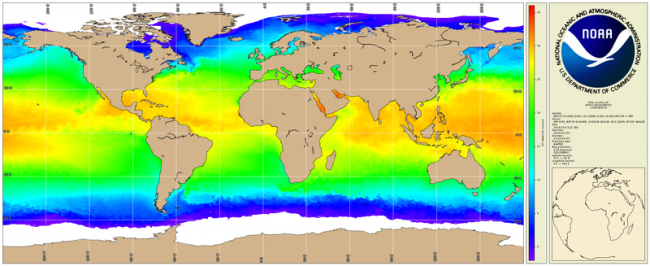
The National Oceanic and Atmospheric Administration's (NOAA) office of National Environmental Satellite Data and Services (NESDIS) generates a daily 0.05° (~5km) global high resolution satellite-based sea surface temperature (SST) analyses on an operational basis. This analysis combines SST data from U.S, Japanese and European geostationary infrared imagers, and low-Earth orbiting infrared (U.S. and European) SST data, into a single high-resolution 5-km product - this grid spacing was chosen to allow the resolution to approach the Nyquist sampling criterion for the mid-latitude Rossby radius (~20 km), in order to preserve mesoscale oceanographic features such as eddies and frontal meanders. The input SST data themselves are also processed in-house via the Geo-SST Bayesian and physical retrieval approach (GOES-E/W, Meteosat-10), and, for polar-orbiting and Himawari-8, the Advanced Clear Sky Processor for Oceans (ACSPO).
Algorithms
The analysis employs a rigorous multi-scale optimal interpolation (OI) methodology that approximates the Kalman filter, together with a data-adaptive correlation length scale, to ensure a good balance between detail preservation and noise reduction. The multi-scale OI employs a quad-tree approach avoids the concomitant computation times that result from pursuing a straight OI methodology, while running the analysis at three different correlation scales (coarse, medium, fine) preserves mathematical rigor. The algorithm is fully described in Khellah et al. (2005).
Validation
The product accuracy verified against globally distributed buoys is ~0.02 K, with a robust standard deviation of ~0.25 K. The new analysis has proven a significant success even when compared to other products that purport to have a similar resolution. This analysis forms the basis for other operational environmental products such as coral reef bleaching risk and ocean heat content for tropical cyclone prediction.
Products
Three blended SST analysis products are generated:
- Day/night which combines both day and night day;
- Night time only which uses only nighttime data;
- Diurnally Corrected Analysis which corrects for diurnal fluctuations on the Day/ night Analysis.
The near real-time products are generated operationally at NOAA/OSPO and re-served by CoastWatch for the convenience of a broader number of users. The night only product has been reprocessed (see below) and is available from Sept. 2002 to 2016.
Reprocessing
The analysis has been run for the period 1 Sept. 2002 through 31 Dec. 2016, incorporating reprocessed geostationary and polar-orbiting SSTs. This has been done primarily to furnish a consistent reference baseline for anomaly-based products such as those generated by Coral Reef Watch.
Future enhancements
Forthcoming enhancements include the incorporation of microwave SST products from low-earth orbiting platforms (e.g. GCOM-W1) in order to improve resolution of SST features in areas of persistent cloud and correct for diurnal effects via a turbulence model of upper ocean heating.
Product Details
| Short Names |
GEO-POLAR
|
|---|---|
| Temporal Start Date |
September 1, 2022
|
| Temporal Coverage |
2002 - Present |
| Product Families |
Sea Surface Temperature
|
| Measurements |
Sea Surface Temperature - Geostationary
Sea Surface Temperature - Polar-orbiting
|
| Processing Levels |
Level 4
|
| Latency Groups |
0 Hours <= 24 Hours (NRT)
|
| Latency Details |
Less than 24 hours |
| Spatial Resolution Groups |
2km+
|
| Spatial Resolution Details |
5km |
| Data Providers |
NOAA
NESDIS
OSPO
|
Spatial Coverage
Global
| Description |
180W - 180E |
|---|
Platforms
Instruments
Documentation
- Maturi, E., A. Harris, J. Mittaz, J. Sapper, G. Wick, X. Zhu, P. Dash, and P. Koner, 2017: A New High-Resolution Sea Surface Temperature Blended Analysis. Bull. Amer. Meteor. Soc., 98, 1015–1026, https://doi.org/10.1175/BAMS-D-15-00002.1
- Ignatov, Alexander, Xinjia Zhou, Boris Petrenko, Xingming Liang, Yury Kihai, Prasanjit Dash, John Stroup, John Sapper, and Paul DiGiacomo. "AVHRR GAC SST Reanalysis Version 1 (RAN1)." Remote Sensing 8, no. 4 (April 9, 2016): 315. doi:10.3390/rs8040315.
- Liu, Gang, Scott F. Heron, C. Mark Eakin, Frank E. Muller-Karger, Maria Vega-Rodriguez, Liane S. Guild, Jacqueline L. De La Cour, et al. "Reef-Scale Thermal Stress Monitoring of Coral Ecosystems: New 5-Km Global Products from NOAA Coral Reef Watch." Remote Sensing 6, no. 11 (November 20, 2014): 11579-606. doi:10.3390/rs61111579.
- Donlon, C.J., Martin, M., Stark, J., Roberts-Jones, J., Fiedler, E., and Wimmer, W., The Operational Sea Surface Temperature and Sea Ice Analysis (OSTIA) system, Remote Sens. Environ., 116, 140-158, doi:10.1016/j.rse.2010.10.017, 2012.
- Reynolds, R.W., and Chelton, D.B., Comparisons of daily sea surface temperature analyses for 2007-08, J. Climate, 23, 3545-3562, 2010.
- Khellah, F., P.W. Fieguth, M.J. Murray and M.R. Allen, Statistical Processing of Large Image Sequences, IEEE Trans. Geosci. Rem. Sens., 14, 80-93, 2005
- Liu, Gang, Alan E. Strong, and William Skirving. "Remote Sensing of Sea Surface Temperatures during 2002 Barrier Reef Coral Bleaching." Eos, Transactions American Geophysical Union 84, no. 15 (April 15, 2003): 137-41. doi:10.1029/2003EO150001.
- Harris, A., and Maturi, E., Assimilation of Satellite Sea Surface Temperature Retrievals. Bull. Amer. Meteor. Soc., 84, 1575-1580, 2003. doi:10.1175/BAMS-84-11-1575 Thiébaux, J., Rogers, E., Wang, W., and Katz, B., A New High-Resolution Blended Real-Time Global Sea Surface Temperature Analysis. Bull. Amer. Meteor. Soc., 84, 645-656, 2003.