Ocean Surface Vector Winds (OSVW; magnitude and direction) from the Ocean Scatterometer (OSCAT) on SCATSAT-1.
Data Access
Product Overview
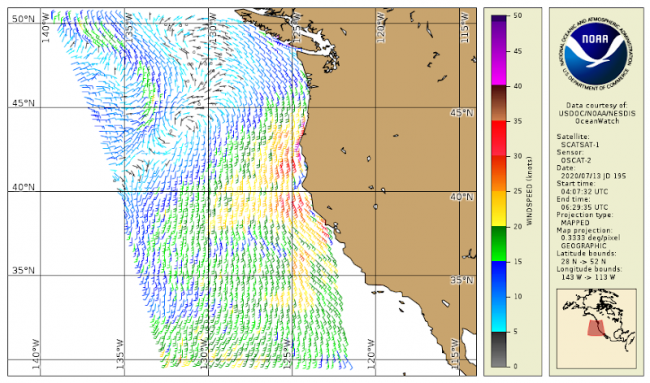
OSCAT-2, aboard the SCATSAT-1 mission of the Indian Space Research Organization (ISRO), is an active microwave sensor used to determine ocean surface level wind vectors through estimation of radar backscatter. The ISRO sensor data are processed by the NOAA OSVW team to estimate wind speed and direction in near real time with global coverage, every 4 hours with a spatial resolution of about 12.5 km. NOAA CoastWatch maps and distributes the OSVW products. See the "information" and "data access" tabs for more.
Product Details
| Temporal Coverage |
Near real-time + 3 days |
|---|---|
| Product Families |
Sea Surface Winds
|
| Measurements |
Sea Surface Vector Winds
|
| Processing Levels |
Level 3
|
| Latency Groups |
0 Hours <= 24 Hours (NRT)
|
| Latency Details |
Less than 24 hours |
| Spatial Resolution Groups |
2km+
|
| Spatial Resolution Details |
12.5 km |
| Data Providers |
NOAA
NESDIS
OSPO
|
Spatial Coverage
Global
| Description |
180W - 180E |
|---|