Level 1

Data products are discrete, instrument-specific datasets containing unprocessed data at full resolution, time-referenced, and annotated with ancillary information including data quality indicators, calibration coefficients and geo-referencing parameters.

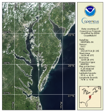
Synthetic Aperture Radar Imagery (NRCS)

Product Families
Sea Surface Roughness
Summary

Spaceborne Synthetic Aperture Radar (SAR) imagery maps the surface microwave radar reflectivity at resolutions from a sub-meter to 100 m depending on the particular SAR satellite and mode. Since a radar provides its own illumination, imagery is independent of the time of day. At typical radar frequencies, SARs can image through clouds, so SARs are considered "all-weather" instruments.  Several gephysical parameters can be derived from SAR including sea surface wind speed.

Synthetic Aperture Radar (Surface Roughness) Winds

Product Families
Sea Surface Roughness
Sea Surface Winds
Summary

Spaceborne Synthetic Aperture Radar (SAR) imagery maps the surface microwave radar reflectivity at resolutions from a sub-meter to 100 m depending on the particular SAR satellite and mode. Since a radar provides its own illumination, imagery is independent of the time of day. At typical radar frequencies, SARs can image through clouds, so SARs are considered "all-weather" instruments.  Several geophysical parameters can be derived from SAR including sea surface wind speed.

MSI Sentinel-2 Imagery

Product Families
True Color Imagery
Summary

MSI Sentinel-2 high spatial resolution imagery and data from Copernicus are served from CoastWatch for coastal US regions in near real time as the data become available.  JPEG and TIF images as well as zipped Level 1C data are available.

True Color OLCI Sentinel-3A/B

Product Families
True Color Imagery
Summary

OLCI true color products are generated from atmospheric corrected rho_s bands.  Data are available in mapped 300m regions in near real-time CoastWatch HDF format and are compatible with the CoastWatch Utilities. 

Ocean Color - Radiances from MOBY - Field Observations

Product Families
Field Observations (In situ)
Ocean Color
Summary

The Marine Optical BuoY (MOBY) project provides in situ data for the vicarious calibration of ocean color satellite data (Clark et al., 1997).  MOBY is a hyperspectral optical instrument system moored off the island of Lanai in Hawaii.  The system was designed for measuring sunlight incident on (surface irradiance) and emitted out of (water-leaving radiance) the ocean.  These measurements are provided in near real time for the vicarious calibration procedures conducted by ocean color scientists and also used for routine monitoring of satellite sensor performance. MOBY has been funded by NOAA since October 2007.